
Wilmington sits where the Cape Fear River meets the Atlantic, wrapped in marshland, historic rooftops, and miles of coastline that simply cannot be captured from the ground. If you have ever scrolled past a real estate listing that looked flat, or watched a marketing video that failed to show what makes a property or event actually special, the missing piece was probably altitude. That’s where aerial photography in Wilmington changes the outcome. At Luma 3 Productions, we specialize in professional, FAA-compliant drone photography and videography built specifically for Wilmington’s coastal geography, its real estate market, and the businesses that call this city home.
This guide walks through what aerial photography actually is, how drone photography works, what it costs, and what Wilmington property owners, realtors, and businesses need to know before booking a shoot. Whether you’re comparing vendors or just researching your options, you’ll find straightforward, no-fluff answers below.
Why Wilmington Businesses and Homeowners Are Turning to Aerial Photography
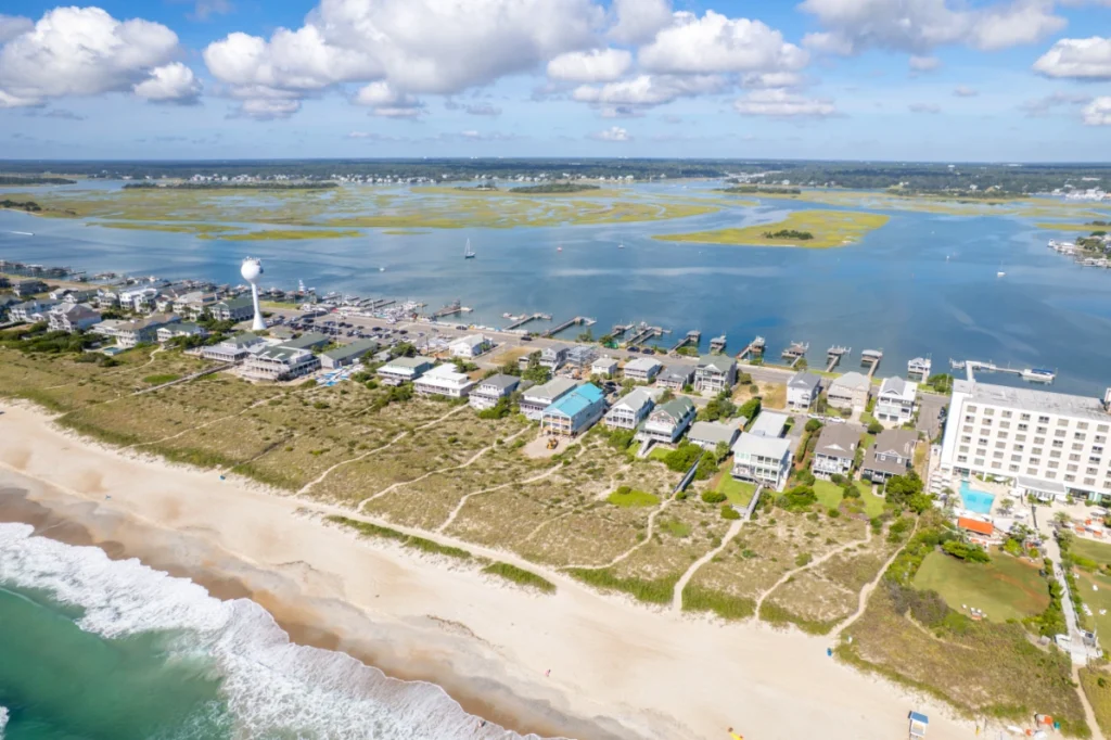
Wilmington isn’t a typical inland city, and that matters more than most people realize when it comes to visual marketing. Properties near Wrightsville Beach, Landfall, or the Cape Fear River often have their best features – water frontage, dock access, acreage, or proximity to downtown – invisible from street level. A ground photo of a waterfront home shows a house. An aerial photo shows the house, the dock, the marsh, and the water beyond it in a single frame.
The same logic applies to commercial clients. Construction firms need progress documentation that shows an entire site, not just one angle. Marinas and tourism businesses need footage that captures scale and setting. Local governments and land developers need accurate imaging for planning and permitting. In every case, the value of going aerial isn’t decoration; it’s information that ground-level photography simply cannot provide.
Demand has grown steadily across the Cape Fear region as more realtors, builders, and event planners recognize that buyers and clients now expect aerial content as a standard, not a luxury add-on. A listing without drone photography increasingly looks incomplete next to one that has it.
What Is Aerial Photography and What Is Aerial Imaging?
These two terms get used interchangeably, but there’s a subtle distinction worth understanding.
Aerial photography refers to any photograph taken from an elevated position above the ground, historically from airplanes, helicopters, or even balloons, and today almost exclusively from drones for small to mid-scale projects. It’s the practice of capturing still images from the air to show scale, layout, and surroundings that ground photography cannot.
Aerial imaging is a broader term that includes photography but also covers video, thermal imaging, mapping, and data capture from the air. A real estate client typically wants aerial photography, a beautiful still image or short video. A construction or agricultural client might want aerial imaging, which could include topographic mapping, thermal scans for roof inspections, or volumetric measurements of a stockpile or excavation site. Understanding which one you actually need helps you hire the right kind of provider and avoid paying for capabilities you don’t need.
What Is Drone Photography and How Is It Different?
Drone photography is the modern method of capturing aerial photography using an unmanned aerial vehicle, or UAV, equipped with a high-resolution camera. It has largely replaced manned aircraft for local and regional shoots because drones are far more affordable, more maneuverable, and able to safely fly at lower altitudes where detail matters most, like hovering thirty feet above a rooftop instead of circling at a thousand feet in a helicopter.
The difference between hiring a drone photographer and a traditional aerial photographer comes down to precision, cost, and flexibility. A drone can capture a slow, cinematic reveal of a property, hold a stable shot directly over a dock, or fly a repeatable path along a construction perimeter, all things that would be impractical or prohibitively expensive with a manned aircraft. For nearly every residential, commercial, and event application in the Wilmington area, drone photography is the practical and professional standard.
How Does Drone Photography Work?
A professional drone shoot is not as simple as flying a camera into the air and pressing record. There’s a structured process behind every quality result, and understanding it helps explain why hiring an experienced operator matters.
Pre-Flight Planning
Before any drone leaves the ground, a professional checks local airspace restrictions. Wilmington International Airport (ILM) has controlled airspace nearby, which means certain flights require FAA authorization through the LAANC system before takeoff. Weather, wind speed, and lighting conditions are also reviewed, since golden hour light dramatically changes how a property or landscape photographs.
Equipment Setup and Flight Execution
Once cleared, the pilot sets up the drone, calibrates the camera settings for the specific lighting and subject, and plans the flight path. For real estate, this typically means a series of establishing shots, a slow ascent to reveal the surrounding property, and closer detail passes over key features like a pool, dock, or landscaping. For commercial or construction clients, the flight path is often more systematic, covering a full site perimeter or specific progress markers.
Post-Processing and Delivery
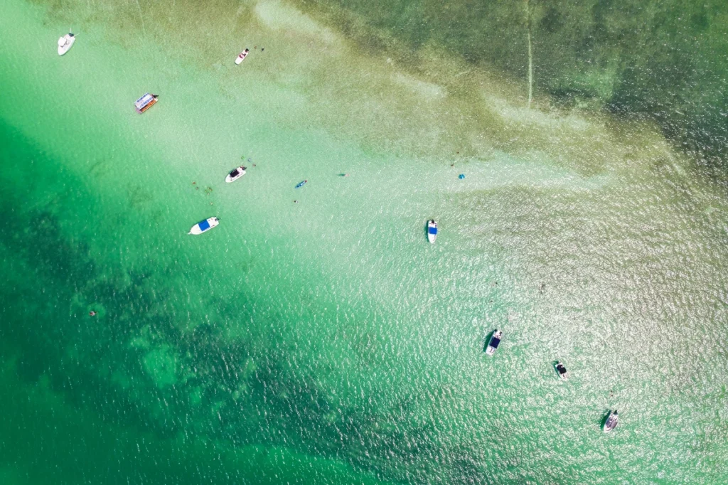
Raw drone footage and photos almost always need editing. This includes color correction, exposure balancing, stabilization for video, and sometimes stitching multiple images together for panoramic or mapping purposes. The final deliverables are then compressed and formatted for their intended use, whether that’s an MLS listing, a social media reel, or a printed marketing brochure.
This full workflow – planning, compliance, execution, and editing – is what separates a professional aerial photography service from someone flying a consumer drone as a side hustle.
Drone Photography Services We Offer in Wilmington
Luma 3 Productions provides a full range of aerial photography and videography services tailored to the needs of Wilmington’s residential, commercial, and event markets.
Real Estate Aerial Photography
High-resolution aerial stills and video walkthroughs designed for MLS listings, luxury property marketing, and land parcels. This includes twilight aerial photography, which has become one of the most requested upgrades for waterfront and luxury listings in the region.
Construction and Commercial Site Documentation
Recurring aerial documentation for builders and developers tracking project progress over weeks or months, giving stakeholders a clear, time-stamped visual record without needing site visits.
Event and Wedding Aerial Coverage
Drone footage that captures the full scale of an outdoor wedding, festival, or corporate event, often used alongside ground-based videography for a complete visual package.
Marketing and Tourism Content
Aerial video and photography for hotels, marinas, restaurants, and tourism boards that want to showcase Wilmington’s coastline, downtown riverfront, and beach communities in their advertising.
How Much Does Drone Photography Cost for Real Estate?
Pricing for real estate aerial photography in the Wilmington area typically ranges from $150 to $450 for a standard package, depending on the size of the property, the number of images or video length requested, and whether twilight photography or a full video walkthrough is included. A basic package usually covers a set of edited aerial stills, while bundled packages that combine drone photography with ground photography and video tend to offer better overall value for realtors marketing higher-end listings.
Larger properties, land parcels, or shoots requiring multiple site visits will fall on the higher end of that range. It’s worth asking any provider for an itemized quote so you know exactly what’s included before booking.
How Much Do You Charge for Drone Photography?
At Luma 3 Productions, our rates are based on project scope rather than a flat one-size-fits-all number, because a five-minute residential flyover and a full-day commercial video shoot require very different amounts of time, equipment, and editing. Generally, our pricing structure looks like this:
- Standalone aerial photo packages typically start around $150 to $250
- Combined photo and video real estate packages typically run $300 to $500
- Commercial and construction documentation projects are quoted per project based on frequency and scope
- Event coverage is priced based on event length and deliverable format
We provide upfront, written quotes before any shoot is booked, so there are no surprise charges after delivery.

What Do I Need to Take Drone Photography?
For anyone considering drone photography as more than a hobby, or for clients wanting to understand what a professional actually needs to legally and safely deliver results, here’s what’s required.
- An FAA Part 107 Remote Pilot Certificate, required by law for any commercial drone operation in the United States
- Liability insurance, since property damage or accidents without coverage can create serious financial and legal exposure
- A drone equipped with a high-resolution camera capable of capturing images sharp enough for print and professional use
- Knowledge of local airspace restrictions, particularly critical in Wilmington given the proximity to ILM airport controlled airspace
- Editing software and workflow experience to turn raw footage into polished, client-ready deliverables
Flying a drone recreationally requires far less, but any photographer offering paid services without FAA certification is operating illegally, and hiring one puts you at risk if something goes wrong on your property.
What Do I Need to Take Drone Photography for Real Estate Specifically?
Real estate aerial photography adds a few specific requirements on top of the basics above. You need permission to fly over the property being photographed (usually a non-issue for the listing agent or homeowner, but relevant for surrounding parcels), an understanding of how to time shoots around golden hour lighting for the most flattering results, and familiarity with MLS image specifications so files are properly sized and formatted for upload. A drone photographer working in real estate should also know how to compose shots that highlight lot lines, water access, and proximity to neighborhood amenities, since these are often the deciding factors for buyers.
Why Choose Luma 3 Productions for Aerial Photography in Wilmington
Hiring a local, licensed team makes a measurable difference in the final product. Luma 3 Productions operates as a fully FAA Part 107 certified and insured drone photography service based in the Wilmington area, which means every flight is legal, documented, and covered. Beyond compliance, our team understands the specific geography of the Cape Fear region, from navigating restricted airspace near ILM Airport to knowing which angles best showcase a Wrightsville Beach waterfront home versus a downtown historic property.
We work directly with realtors, builders, event planners, and local businesses to deliver aerial photography and video that’s edited, formatted, and delivered on a timeline that fits real estate and marketing deadlines. Every project includes a written quote before booking, clear communication about weather contingency planning, and final files delivered in formats ready for MLS, social media, or print.
How to Book Your Aerial Photography Session
Booking with Luma 3 Productions starts with a short consultation about your property, event, or project so we can recommend the right package and check airspace or weather considerations ahead of time. Most residential real estate shoots can be scheduled within a few days, while commercial and event bookings are recommended two to three weeks in advance to guarantee availability. Reach out for a free, no-obligation quote and let’s plan a shoot that shows your property or business the way it deserves to be seen, from above.
FAQ’s
Do I need to be present during my aerial photography session?
No. While you’re welcome to be there, most residential and commercial shoots don’t require the property owner or agent to be present, as long as access has been arranged in advance.
Is drone photography legal everywhere in Wilmington?
Most of Wilmington is open airspace, but areas near ILM airport require FAA authorization before flying. Licensed operators handle this clearance automatically as part of pre-flight planning.
How long does a typical aerial photography shoot take?
Most residential real estate shoots take 30 to 60 minutes on site. Commercial or event coverage varies based on scope, typically ranging from one to several hours.
What weather conditions affect drone photography?
High winds, rain, and fog can delay or reshape a shoot. Providers typically build weather contingency days into scheduling, especially for time sensitive real estate listings.
How soon will I receive my edited photos or video?
Turnaround is usually 24 to 72 hours for standard real estate packages. Larger commercial or video projects may take slightly longer depending on editing complexity.
Can drone photography be combined with ground photography?
Yes, and it’s one of the most popular options. Combining aerial and ground level photography gives a complete visual package, especially valuable for higher end real estate listings.

